| From | To | Distance | Ascent | Descent |
| Baxters Ridge | Blue Knob | 59 | 202 m | 2040 m |
| Blue Knob | Yarras | 50 | 2600 m | 2340 m |
| Yarras | Kookaburra | 59 | 2010 m | 1140 m |
| Total | 168 km |
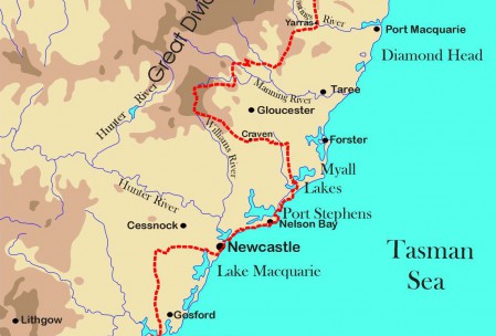
The walking route runs along Baxters Ridge before dropping down into the Nowendoc Valley and then climbing into the temperate rainforest of Tapin Tops National Park, Bulga State Forest, Doyles River State Forest and Biriwal Bulga National Park before crossing the Hastings River Valley to rise again into Werrikimbe and Willi Willi National Parks with their lush, sub-tropical rainforests.
Along the way there are mute reminders of the size of the forestry industry before it ran out of old growth forest with the foundations of a huge sawmill at Yarras and the last building in the once thriving forestry settlement of Kookaburra.

