| From | To | Distance | Ascent | Descent |
| Thredbo | Limestone Creek | 68 | 1348 | 1791 |
| Limestone Creek | Corryong Road | 56 | 1976 | 2241 |
| Total | 124 km |
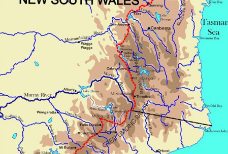
You leave the decadent delights of Thredbo behind you to stroll beside the Thredbo River from the village to Dead Horse Gap. At Dead Horse Gap, the Federation Track rejoins the Alpine Track as it wanders through the Pilot Wilderness. After crossing the Big Boggy River there is a long, gradual climb over Bobs Ridge which provides some magnificent views back to the Ramshead Ranges.
From the top of Bobs Ridge the track meanders down to Cascade Creek and then climbs again to follow the Dividing Range to Tin Mine, the site of an old mining settlement, one of the many huts and huts and abandoned homesteads of the pioneers of this tough country now peopled only by the wild brumbies and bushwalkers. From Tin Mine the track follows an old mining road that ran from this mine right through to Cowombat Flat and then on to Benambra in Victoria. Five kilometres south of Tin Mine, the Pilot is reached and a detour to its summit is essential as the views of the Main Range to the north and the Cobberas to the south should not be missed.
Shortly after the Pilot, Cowombat Flat, a huge natural grassland that straddles the NSW-Victoria border as it follows the insignificant headwater of the mighty Murray. South of Cowombat the snow gums return but the footpad from the Cowombat Firetrail down to the Limestone Valley provides more open views of the gullies and ridges of this remote area. From Limestone Creek, the Alpine Track runs west across several climbs and descents but these are offset by the magnificent views across countless mountain ranges from the ridge tops. The valleys have plenty of fresh water and there is plenty of wildlife as this country is very isolated. It is hard to believe that this area once teemed with gold seekers and apart form the occasional mullock heap there is little evidence of their passing although the abandoned workings of the wolfram mine at Mt Murphy are quite extensive. Whilst navigation is a little difficult, the track wanders through huge mountain gums, past tree-fern filled gullies and along grassy clearings beside crystal clear creeks before arriving at the Corryong Road.

